It is very difficult for humans to want to permanently change the natural environment. No matter how clever the technical means are, nature will always end up defeating and reluctantly returning to its original form.
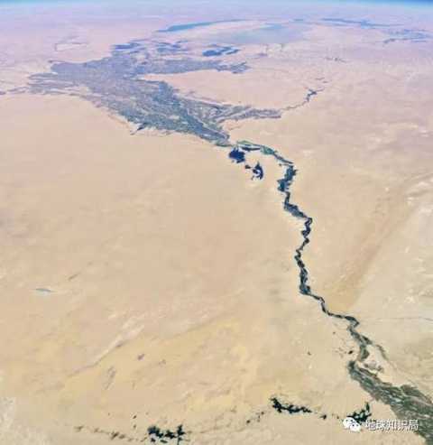
However, with the increase of human activities and the advancement of technology, the story of the temporary modification of the natural environment is not uncommon. The Aral Sea in Central Asia is one of the victims.
Today's Aral Sea has been declining by more than 90% (more than 60,000 square kilometers) in 1960, equivalent to four big Beijings.
Today's article will take you to see the mystery of life and death in this huge saltwater lake.
This article is reproduced from the WeChat public account "Earth Knowledge Bureau" (ID: diqiuzhishiju), does not represent the point of view of think tanks.
1
Beautiful salty sea of ​​lush years
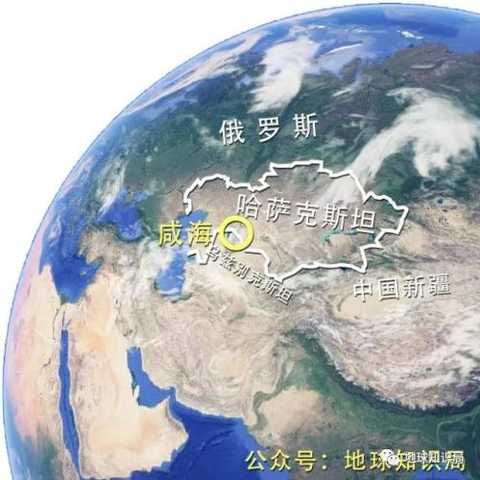
The Aral Sea, located at the junction of Kazakhstan and Uzbekistan, was once the fourth largest lake in the world. Studies have shown that the Aral Sea was born in the "Pliocene" period, more than 5 million years old. The two famous rivers in Central Asia, the Syr River and the Amu Darya, were injected into the Aral Sea to maintain the stability of the salt water.
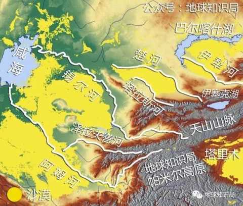
Benefiting from many high mountains and plateaus in central Asia, many large rivers flow around, including the famous Central and Central Rivers: the Amu Darya and the Syr River to the Aral Sea.
Due to the geographical environment and the influx of river water, the water in the Aral Sea is layered, the water circulation is clockwise, the surface seawater is not high, and the salt is rising to the bottom. The water in the Aral Sea is very good, the transparency of the water is very high, and the deep blue water is particularly beautiful against the sunlight. Because there are about 1,500 islands in the lake, the Aral Sea is also known as the "sea of ​​the island", with a total area of ​​over 66,000 square kilometers.
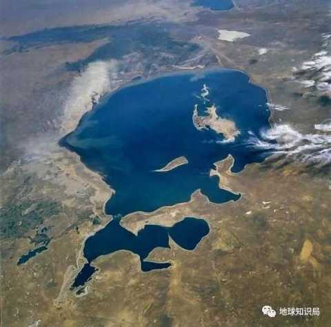
The Aral Sea in August 1985
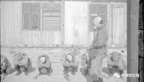
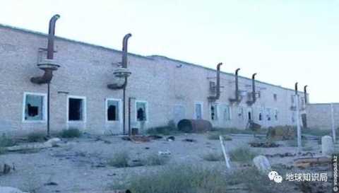
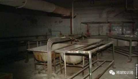
It was a strategic rear in the Soviet era, and relatively safe in the Far East and the developed regions of the West. For this reason, the Soviet Union once set up its own research base for biological and chemical weapons on the island of Wozrozhniye (also known as "Revival Island") surrounded by lake water, codenamed "Aralsk-7" or "third laboratory". The game "Call of Duty" has also been used as a background.
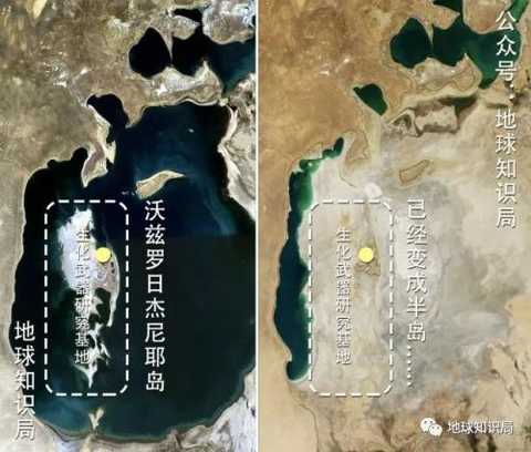
In the Aral Sea, the island of Wozrozhniye, this island became a peninsula in the middle of 2001 due to the depletion of the Aral Sea and the land.
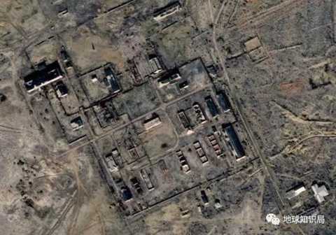
Biochemical weapons research base
Due to the uncertain winds here, the island has specially built a Mi-shaped airport to ensure that the military aircraft will land at any time. But after the collapse of the Soviet Union, this mysterious base was eventually abandoned and became a no-man's land.
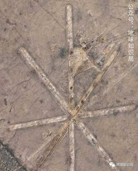
The Mi-shaped airport is on the line, and the Russian military’s combat power is not normal.
Nowadays, due to the proper salt content and good water quality, the fishery resources of the Aral Sea in the past are very rich. The lake is rich in fish such as squid, salted sea bream, dark spot pike, flounder, salty sea red-tailed fish and black scorpion.
Before 1960, commercial fishing here exceeded 43,000 tons per year, accounting for one-sixth of the total Soviet fishing, and it was the Soviet fishery production base. In 1921, the fishermen here also transported 14 cars of fish to Moscow to ease the famine there. To this end, Lenin wrote a letter specifically to express his gratitude.
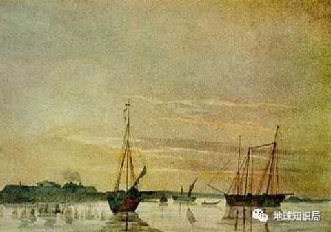
In 1848, the first Russian boat moored in the Aral Sea, drawn by Taras Shevchenko, the Russian navy anchored in the Aral Sea
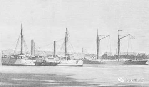
The disappearing Aral Sea
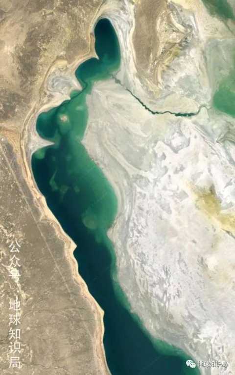
But the good times are not long, and the good times of the Aral Sea have gradually become an old dream that is difficult to reproduce under the human activities. The beautiful and rich aral sea began to wither.
2
Result of quick success
After the founding of the Soviet Union, the government hoped that by building water conservancy facilities, the rivers of the Syr and Amu rivers would flow into the surrounding deserts and wasteland, thus transforming the area into a cotton grain production base.
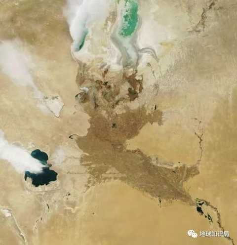
A large amount of water in the Aral Sea is used for agricultural development in the lower reaches of the Amu Darya.
To this end, Stalin proposed the "natural transformation plan" in the 1940s. The specific content of the plan is to build wind-proof and sand-fixing forests, introduce pasture rotations, and construct irrigation and water conservancy projects in semi-arid climate areas. The construction of water conservancy facilities nourished the crops, but they separated some of the river water, and the water inlet and outlet balance began to be broken. The waters of the Aral Sea began to decay.
However, due to the lack of time to pump the river, the natural transformation plan was in the early stages of operation and did not cause a serious crisis.
In the 1950s, the Soviet government divided the entire Soviet Union into 18 basic economic zones for targeted development. Among them, Uzbekistan, Kyrgyzstan, Tajikistan and Turkmenistan have become Central Asian economic zones, and together with the neighboring Kazakhstan Economic Zone, they have developed cotton and grain-based farming.
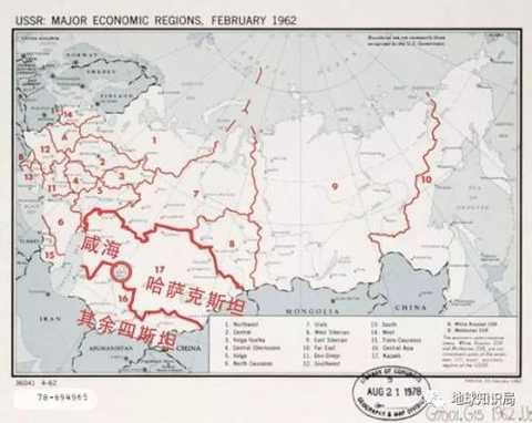
Kazakhstan exploits the Aral Sea together with the remaining Sistan
This plan prompted the Soviet government to build a large number of water conservancy facilities in the area. Water diversion projects represented by the Karakum Canal and the Ambhjar Water Diversion Canal and the Tashsaka Water Diversion Canal appeared on the land of Central Asia. These huge water conservancy facilities transformed Uzbekistan’s “craving grassland†and Karakum desert from a barren land into a cotton grain production base with an area of ​​more than 300,000 hectares.

In addition to the distribution of water resources, the Toktogul dam in the upper reaches of the Syr Darya provides more than half of the electricity in Kyrgyzstan.
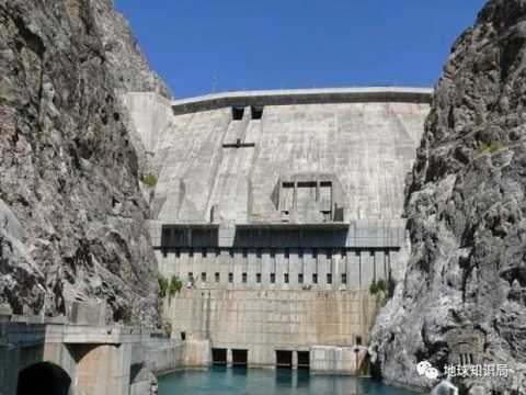
Toktogul dam long
From the perspective of short-term stimulus to the economy and the development of natural resources, the work of the Soviet government is fruitful.
In 1980, the annual output of cotton in the Soviet Union reached 9.96 million tons, accounting for 20% of the world's total output, 95% of which was produced in the Syr Darya and Amu Darya areas. About 40% of the rice in the Soviet Union, 25% of vegetables, fruits, and 32% of the grapes are also produced in the area.
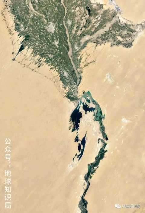
Crossing the banks of the Amu Darya in the desert
The bumper harvest of agricultural production has contributed to the economic development of the region, and the population of this region has soared from more than 7 million in the 1920s to more than 36 million. The wilderness that has never been farmed has become an agricultural star.
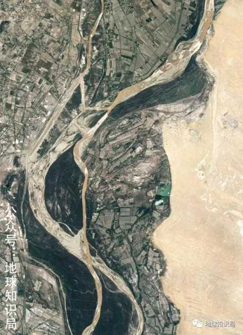
But like all the fast-moving economic developments, environmental problems around the Aral Sea have begun to emerge. The extensive development model of the Soviets made the water waste in the region serious. Many water resources evaporated and leaked during the transmission process and were not effectively utilized.
In order to fight for political achievements, the responsible persons in various places have made the land for land reclamation far greater than the water resources of the region. The amount of water injected into the Aral Sea is getting less and less, and the coastline is constantly retreating. The former port became an inland city, and the water transport economy of the Aral Sea almost collapsed.
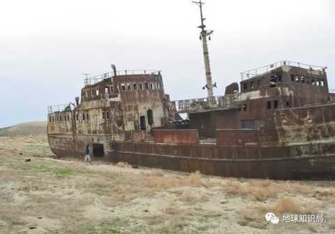
Abandoned ship near the Aral Sea
The climate here has also become more extreme and arid as the lake has subsided, resulting in a decline in crop yields in the surrounding areas. The reduction in water volume has led to a sharp rise in salt concentration in salty waters, causing massive extinction of native fish and aquatic organisms.
In the 1960s, there were more than 600 species of fish in the Aral Sea. By 1991, there were only 70 species left. Commercial fishing is only one-tenth of the peak of the 1960s.
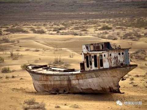
In 1987, the Aral Sea was divided into two parts, the north and the south, and the high seabed in the middle became land. The dry lake bottom deposits a lot of salt, and whenever the wind blows, it will form a terrible "salt sandstorm." These sands containing a large amount of salt are scattered with the wind and deposited in the surrounding fields, causing salinization and desertification of the land, which has led to a sharp decline in crop yields in the region. The fertile land opened by the Soviets has returned to the desert. The water quality of the surrounding rivers and groundwaters is also getting worse due to the loss of water seepage.
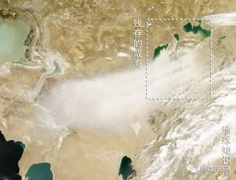
Huge sandstorm across the entire area
Poor drinking water conditions and a lack of food have led to a sharp rise in the incidence of chronic diseases in the region. The humans who once celebrated the victory began to feel the revenge of nature.

Once lakeshore and boat
3
In the skin
In fact, the dryness of the Aral Sea was as expected by the Soviets. The Soviet engineers originally planned to transform the Aral Sea into a good land by letting the Aral Sea plan to dry up. But they seriously underestimated the side effects of this behavior, the speed of cognac greatly exceeded people's expectations, and caused a serious environmental disaster.

I didn’t expect to do so quickly.
In the face of increasingly severe conditions, the Soviet government had to take some measures to ease, and even planned to divert water from other rivers to protect the Aral Sea. However, these plans were ultimately unable to be realized due to the huge cost, and the Aral Sea finally embarked on a road of no return.
After the disintegration of the Soviet Union, the regional situation became more complicated due to the loss of unified dispatch of water resources.
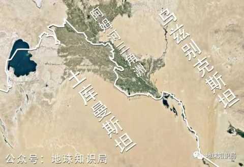
After the collapse of the Soviet Union, Uzbekistan and Turkmenistan shared the lower reaches of the Amu Darya and the delta. Means that you don't pump water, I pump?
Take the Toktogul dam in Kyrgyzstan as an example. It controls the water needed for downstream irrigation and is the main source of electricity for upstream Kyrgyzstan. The dams that have these two functions are operated differently in different countries. It stands to reason that Kyrgyzstan needs to release water in winter to provide electricity; Uzbekistan and Kazakhstan need dams to release water in the summer for irrigation.
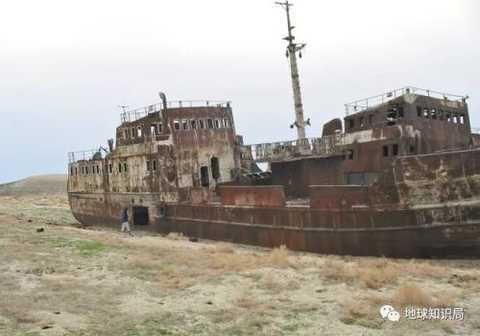
Abandoned ship due to dryness in the Aral Sea
The water resources are limited, and it is impossible to release water at both ends. In order to solve this problem, the Soviet government led the regulation that Kyrgyzstan released water in the summer to exchange oil and gas from Uzbekistan and Kazakhstan.
However, since the disintegration of the Soviet Union in 1991, this agreement has not been well implemented due to the needs of their respective interests. In order to compete for water resources, the three countries have placed their own interests in the first place, wanting to divert the river. All these things have caused less and less water to flow into the Aral Sea. The 滔滔Am River even had a current interruption, which further abrupt the disappearance of the Aral Sea.
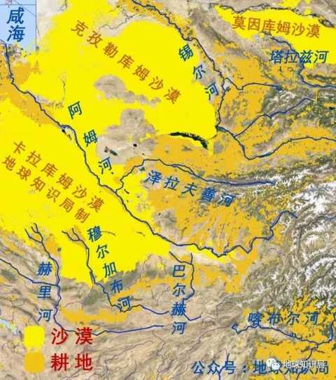
Many large rivers in Central Asia, not only through the vast desert, but also through many human settlements, the most end in the Aral Sea disappeared in the desert
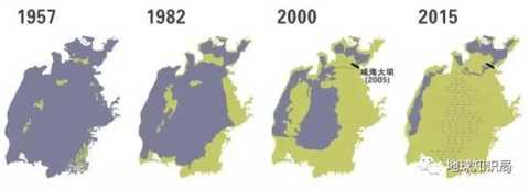
In 2003, the South China Sea, which had just been separated, was divided into two parts.
In 2009, the east disappeared, and the disappearance of the west was almost only a matter of time.
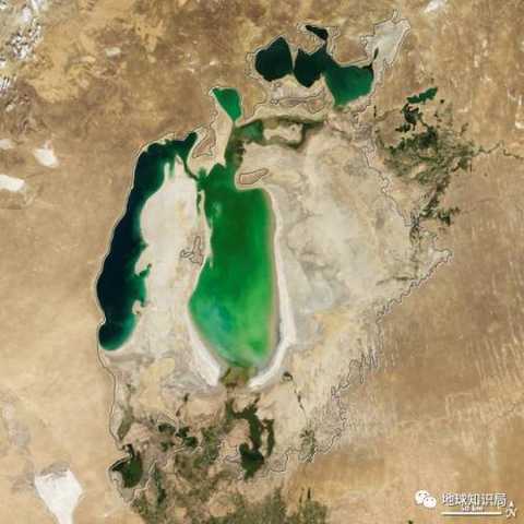
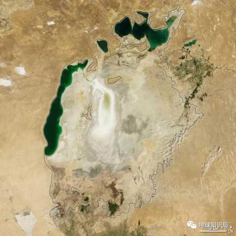
In 2003, the artificial dam divided the Aral Sea into two parts. In 2009, the east disappeared (right).
As of 2014, the area of ​​the Aral Sea has shrunk by 74% from its peak, and its water volume has decreased by nearly 85%. The fishing industry that has flourished in the past has almost disappeared. Due to the large number of people born in the era of agricultural development, they also chose to leave their homes and find opportunities to survive elsewhere.
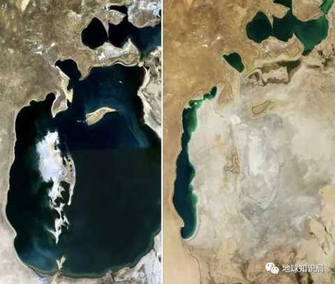
Aral Sea in 1989 and 2014
In order to protect the Aral Sea, Central Asian countries have established committees to coordinate the interests of all countries. The United Nations and relevant international organizations have also set up foundations to carry out special operations to protect the Aral Sea and to drill deep water wells for residents in the surrounding areas to solve the problem of drinking water. The relatively affluent Kazakhstan also specially allocated funds to build a dam to protect the North Aral Sea.
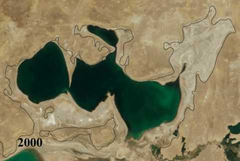
Changes in the North Aral Sea in 2000 and 2011.gif
Although these actions have achieved certain effects, the trend of aquarium attenuation in the upper reaches of the river has not been controlled. Many experts pessimistically stated that the Aral Sea will disappear completely around 2020 and become a sea that exists only in outdated maps.
The Aral Sea is just a microcosm of human damage to the environment. Behind the Aral Sea, more natural terrain and flora and fauna struggle in a deteriorating environment. If humans don't coordinate much, don't want a better way to make more efforts for the safe dispatch of resources, and wait until the natural counterattack is all late.
Director system: Wu Liang
Producer: Xia Yu
Editor in charge: Dai Lili Li Yibo
Black Oxford Shoes,Tan Oxford Shoes,Leather Oxford Shoes,Casual Oxford Shoes
GDMK GROUP WEIHAI SHOES CO., LTD. , https://www.jinhoshoes.com